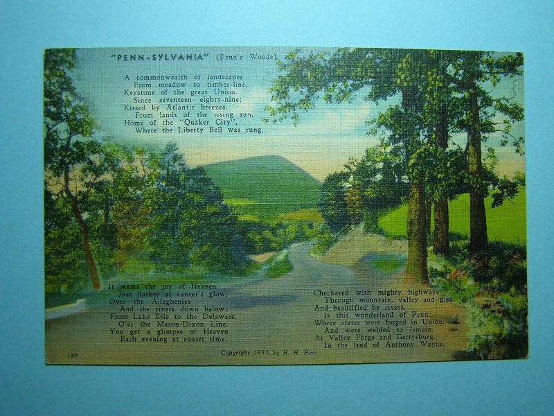
Sullivan County
Route 87
Which Runs Across the County from East to West
Vintage Linen Postcard Dated 1935
Courtesy of Scott W. Tilden
Original Auctioned on eBay in September 2012
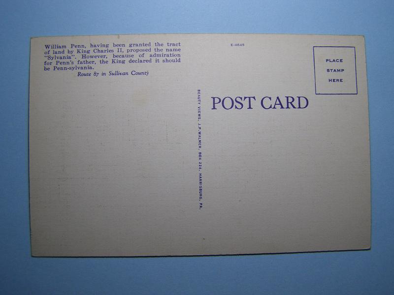
Click Here to See Back of Postcard.
The following list
of
was prepared in 1985 by Dr. J. Wilson Ferguson.
Locations are given according to the 1974
General
Highway Map of
The date when the site was established is shown as ( ).
**Indicates the cemetery was still in use in 1985
Links are added to the transcriptions for each cemetery
as
also
referenced in the history of Churches and Cemeteries posting here:
http://www.rootsweb.com/~pasulliv/churches/churches.html
1. Bernice-Mildred area:
· ** Bernice Cemetery (1886). Behind old Bernice Presbyterian Church (now Bible Baptist)
·
** Trinity
Lutheran Cemetery (1906).
Adjacent to
·
** St.
Francis of Assissi Cemetery (1871).
Adjacent to
2. Ellis Cemetery
(1819)
At Seamans; North of L.R. 56027/T367; 1 1/2 miles
West of Lopez.
3. Dushore Area:
·
** Old
Adjacent to
·
** Caldwallader
Cemetery (1827).
East of L.R. 895 (Turnpike). One mile North of Dushore.
Next to old
·
** Fairview Cemetery
(1840's).
Bahr's Hill on L.R. 895 (Turnpike), at L.R. 56016 1/2 mile Southeast of Dushore.
·
** Friedens
(Peace) Cemetery (1825). Adjacent to
·
** Jackson Cemetery
(Little Germany?) (1832)
West of Rt. 220 just South of intersection with L.R.
56024. On top of hill West of Muller's.
4. Cemetery on "The Commons"
(Irish Settlement) (1840's).
On South side of T379 about 2 miles West of
intersection with T348.
1. Lopez Area:
·
Evangelical
Cemetery (1897).
Behind old
·
** Byzantine
Catholic Cemetery (1905).
Adjacent to Sts. Peter and Paul Byzantine Catholic Church,
T382.
·
Saint Vladimir's
Russian Orthodox Cemetery. (Old).
At east end of T398 (Turrelltown).
·
** Saint Vladimir's
Russian Orthodox Cemetery. (New).
On Jackson Hill along Route 487, one mile Southeast of Lopez
·
** Rado
Mausoleum (1970's).
Across Route 487 from New St. Vladimir's Cemetery
2.** Bella Sylva
Cemetery (1840's?)
Behind site of
3. Junk Cemetery
(1858).
South of private road running East (just North of
4. Rock Burying Ground (1856).
70 yards to East of
5.** Colley Cemetery
(1844).
Next to
6. Ricketts
Cemetery (1918)
On knoll East of Turnpike past North end of
7.Bears Hill Cemetery
-outside
8.Cully Cemetery -outside
1. Sonestown:
·
Old Cemetery
(1850's?).
In town across L.R. 56044 from old
·
Hillside
Cemetery (1905?).
On hill West of town on
2. ** Cherry
Grove Cemetery (1835).
West of L.R. 16, 1 mile South of Nordmont
3.
East of Rt. 220 on hilltop just North of County line.
4.
On hillside East of site of old
** Saint Basil’s
Old Graveyard and Saint
Basil's Cemetery (1836).
West of
1. Maintained by the
·
** German Cemetery.
Southwest of Hugo's Corners across L.R. 56017 from new St. Peter's Church
·
** Bethel Cemetery
(1849).
South of
·
Webster Cemetery
(1860's).
East of L.R. 56019 Southwest of
·
** Estella Cemetery
(1893).
Along Route 154 across from old Estella ballfield
·
Mullan-Pardoe-Grange
Cemetery (1808).
·
** Bear Mountain
Cemetery (1870's).
South of T344 East of T346 intersection
·
** Greenwood
Cemetery (1814).
North of L.R. 56018 near intersection with T434 Not far from Elkland
Church/Camp Meeting
·
** New Friends
Cemetery (1886).
North of Route 154 East of intersection with T440 behind Elkland Friends
Meeting
·
Gleockler
Burial sites (1890)
On old Gleockler farm (Bogert
in 1985), North of L.R. 56015 East of
·
King Burial sites (1859)
On old King farm (Reibson in 1985), West of L.R.
56019 South of T413
·
On Kobbe farm East of Hugo's Corners North of L.R.
56018
·
Everitt
(Williams?) Burial sites (1850's?)
3 children's graves on farm West of
·
Mullan
(?) Burial sites (after 1860?).
On McCarty Ridge West of T424 North of
** Fairmount
Cemetery (1821)
East of Route 87, South of twin bridge
1. Millview Area
·
Old Molyneux Cemetery (1820's?)
On hill North of L.R. 56019 just West of Millview
·
** Millview (Warren) (New Molyneux)
Cemetery (1820's?)
Between Route 87 and Loyalsock Creek, East of Millview
On Shaffer property North of Route 87, East of Millview
2. ** Union
Cemetery (1857)
Near old
3. Bryan
Cemetery (1841)
On West bank of Loyalsock Creek about 1/4 mile below
junction with Big Run. About 2 miles South of Forksville.
1. Maintained by the
·
Old Friends
Cemetery (1820).
East of Shunk across Rt. 154 from
Immediately East of above
Across T418, East of above
Just West of Shunk on L.R. 56031
1.8 miles Northwest of Shunk, North of L.R. 56031 on
Moody farm
2.
.6 mile North of
** Hillsgrove Cemetery (1796/1820).
Adjacent to Union Church on T351 West of Route 87
Just above old railroad cut as it enters Thorndale property from East and turns
South. Across Glass Creek from most of tannery site
1. ** Mountain
Ash Cemetery (1850's).
Across from old
2. ** Sacred
Heart Cemetery (1880's).
Adjacent to Sacred
1. ** Eagles
Mere Cemetery (1813).
On T349 Southwest of Country Club
2. Mount Vernon Cemetery
(1831).
On Edkin Hill in pasture East
of L.R. 56003 North of T307
3.
West of T300 down Howard driveway .8 from
This list was presented to the